Attack on the Church of Saint Porphyrius in Gaza City
Editor's Note: This is one of several open-source intelligence (OSINT) investigations conducted by the NAWA Media Open-Source Investigations Team in collaboration with journalists at The Public Source. These reports were produced in October and November of last year; due to the rapidly escalating violence, the figures are a historical record of that time rather than a reflection of the current reality. Through these reports, we aim to contribute to the growing body of evidence of war crimes and crimes against humanity committed by Israel in its war against the Palestinian people in Gaza. For this reason, the authors of these investigations use precise and cautious language that helps in advancing the prosecution of these crimes in international courts.
About the Incident
Date of incident: 19 October 2023
Time of incident: 20:00 - 20:33 Local time
Location coordinates: 31°30'14.13"N 34°27'45.06"E
Keywords: Pillared, flagged, building (X), tinplated.1
On October 19, 2023, several local and international news outlets and agencies reported an attack on the Church of Saint Porphyrius in the Al Zeitoun area of Gaza’s Old City. The Greek-Orthodox Church of Saint Porphyrius has suffered damage during the continuous war between the Israeli state and Palestinian armed resistance groups.
Civilians who lived in the northern Gaza Strip used the church as a shelter during both the current war and the 2014 Gaza war, when almost 2,000 Palestinians took shelter in the church after fleeing Israeli shelling.
Media, such as the Daily Wire, reported the Israeli occupation forces’ claim that a Hamas command and control center was struck, and that it was located near the church. The occupation forces posted a video showing the attack on a building.
- 1The keywords: Pillared, flagged, and tinplated assist the facilitation of understanding reference by building features common between satellite and street footages.
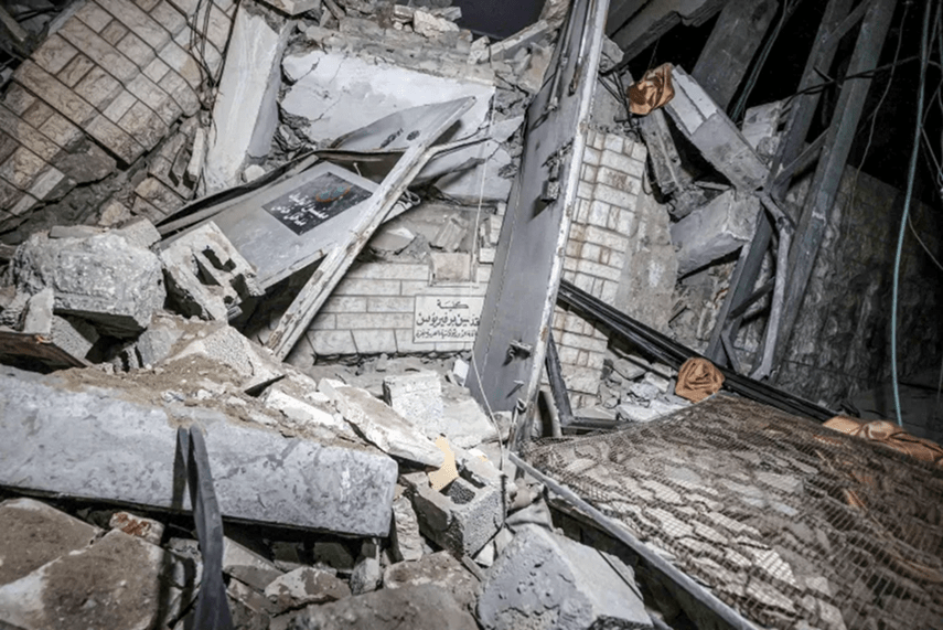
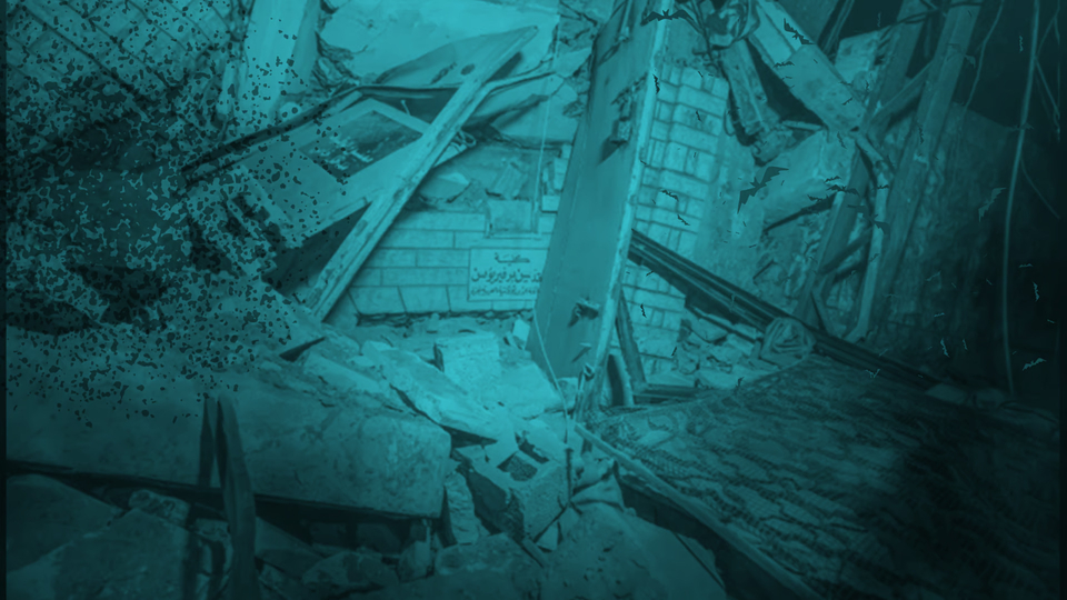
Footage of destruction after the attack on the Saint Porphyrius church, Gaza.
What Happened?
On the evening of October 19, footage published online showed the location and remnants of the attack. The following day, Archbishop Alexios of the Saint Porphyrius Church claimed that the attack occurred at around 20:00 local time on October 19, adding that the structure that was attacked is one of the church's office buildings.
Posts on X (formerly Twitter) confirmed attacks near Kateb Wilaya Mosque on the same night at 21:38 local time in Gaza.
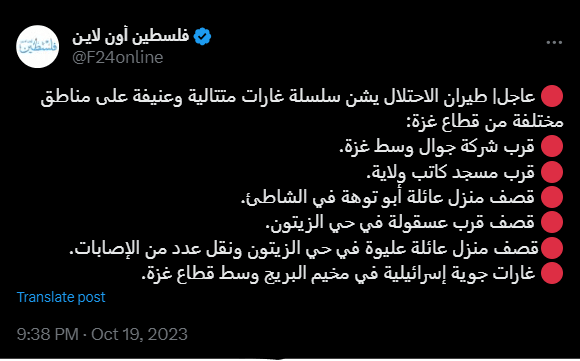
A screenshot of the first post about the incident.
On October 20, Palestinian officials such as Salama Maarouf, head of the Palestinian government’s media office, stated that the Israeli military committed a ‘‘crime’’ by targeting the Saint Porphyrius Church in Gaza and causing tens of casualties.
Locating the Building Struck
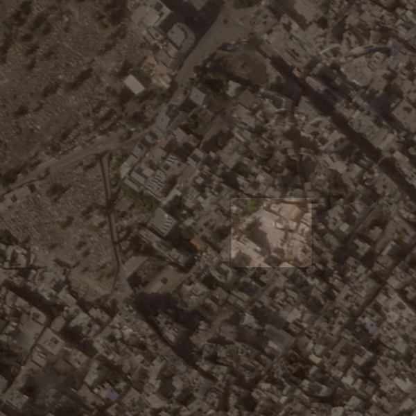
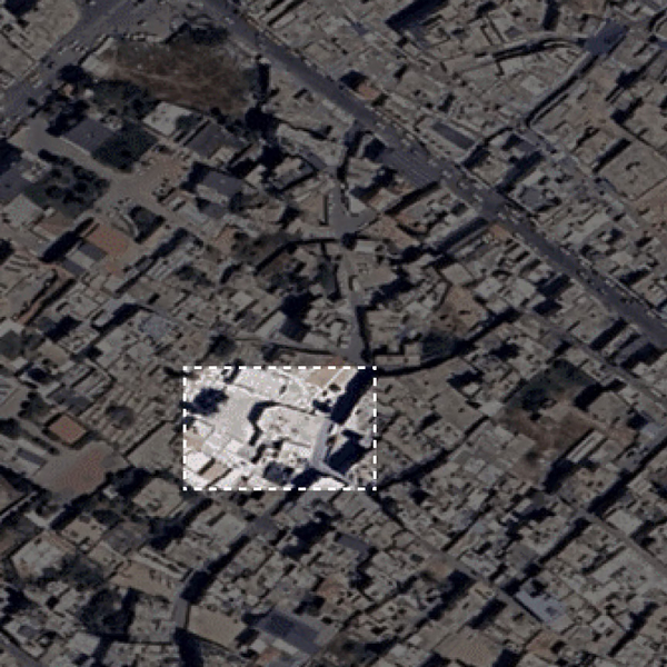
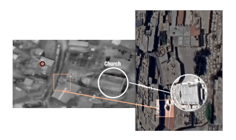
The aerial views of the church's location show the exact building that appeared in media reports of the October 19 attack. Gaza’s Old City includes several significant historical sites, such as the Saint Porphyrius church and the Kateb Wilaya Mosque.
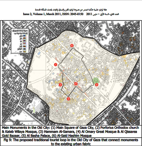
Map of the attacked area. Number 2 on the map: Saint Porphyrius church and Kateb Wilaya mosque facing one another. Magazine 2nd edition.
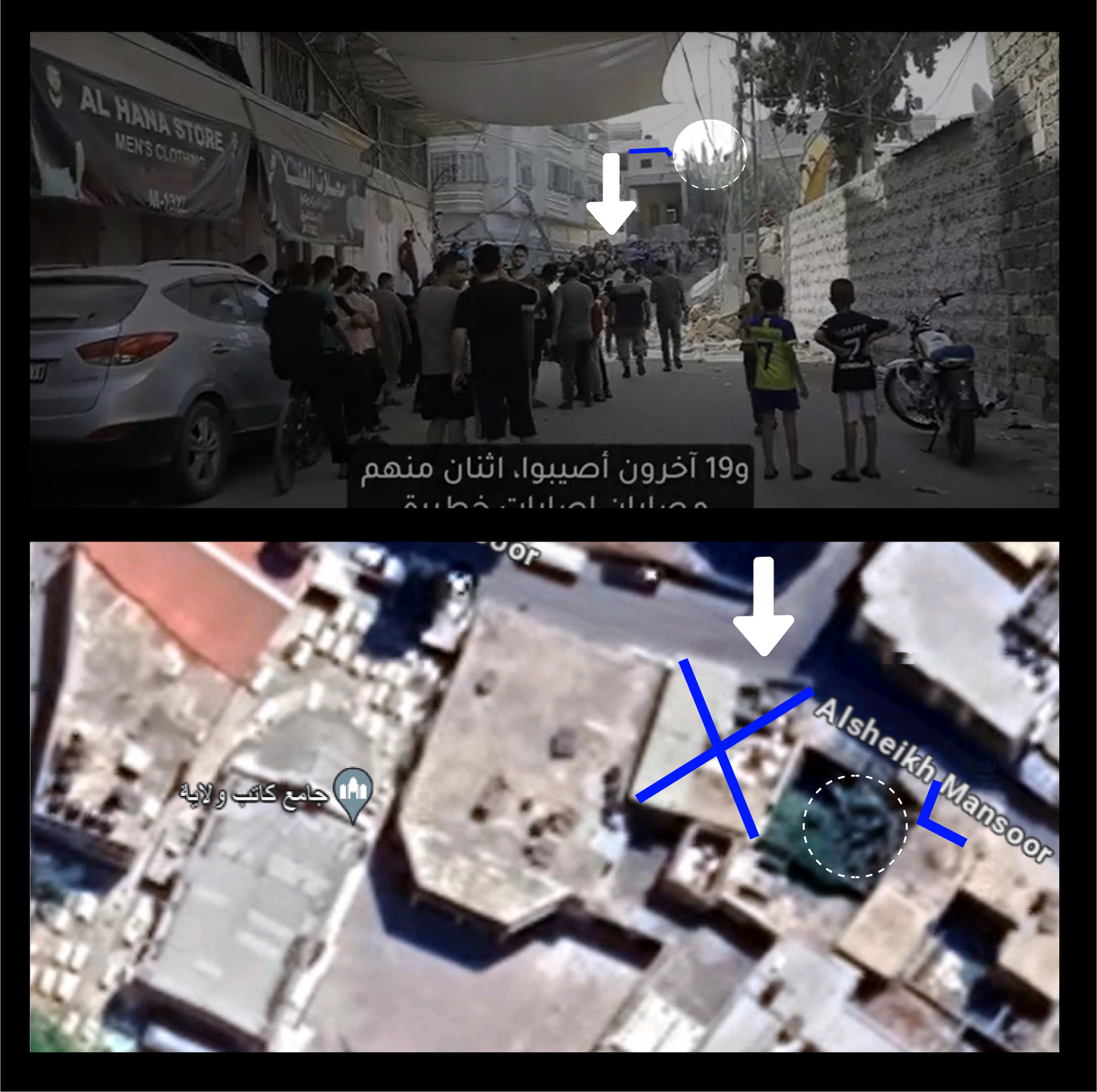
By comparing Google Earth images to footage in local news reports, our team was able to locate the attacked building. The building’s architectural design and the tourist routes of distinctive places in Gaza’s Old City helped us locate the exact building on the church grounds. The building is misrepresented in available online maps, such as Google Earth. We examined online maps and videos from before the war on October 7, 2023 began.
The red and white church flag is a sign of the Orthodox Church's ownership of the building. The following analysis of the connected structure will locate the destroyed building and confirm it based on evidence found in the location.
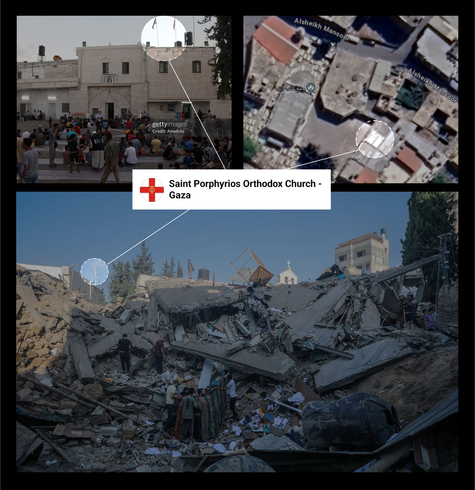
Images presenting a building bearing the flag of the Orthodox Church of Jerusalem within the Saint Porphyrius church complex in Gaza’s Old City. Source: Mohammad Massri. Top left: image from Anadolu Agency. The destruction location: New York Times report.
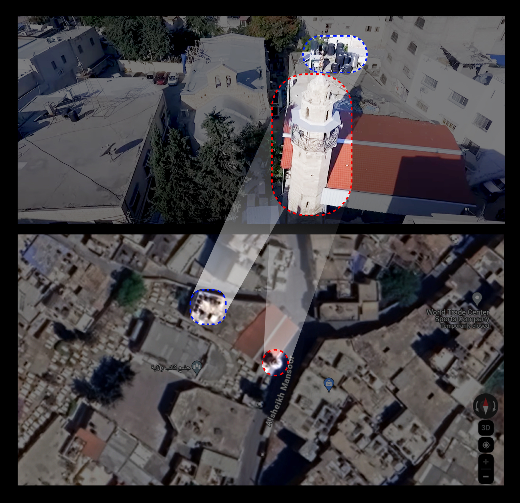
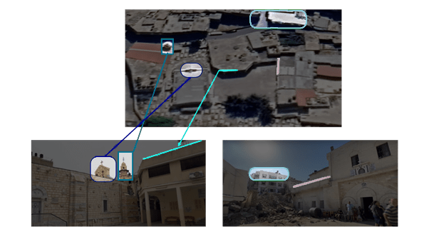
Satellite images and footage from YouTube of the Kateb Wilaya mosque and the Saint Porphyrius church in Gaza. Blue: Saint Porphyrius Church building. Red: Kateb Wilaya mosque.
We were able to detect the exact location of the church on the map by comparing two points in the given geographical area. Shown above, the blue circles identify the old church building, and the red circles identify the Kateb Wilaya mosque, confirming that the church is located next to it. These two points ensure that the investigated location aligns with the different reports presented in this investigation.
Impact Site
The architectural style of Gaza’s Old City played a significant role in our investigation on the structure of the compound. This forces us to reflect on international treaties, such as the 1954 Hague Convention and its Protocols on protected buildings and cultural property. Several buildings in the Old City share similarities because of the period they were all constructed in. For instance, the arches at the Khan al Zait and the church gate are similar. Historical evidence shows that both the area of Kateb Al Wilaya and Khan al Zait (which was demolished in the 1960s) were built during the 14th century, according to researchers.
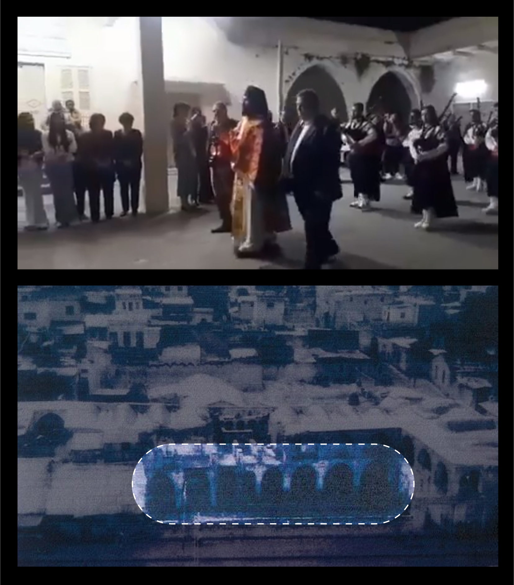
Images of Archaeological sites in Gaza’s Old City: Khan Al-Zait, the Old City of Gaza, and the church. Facebook, video of a ceremony.
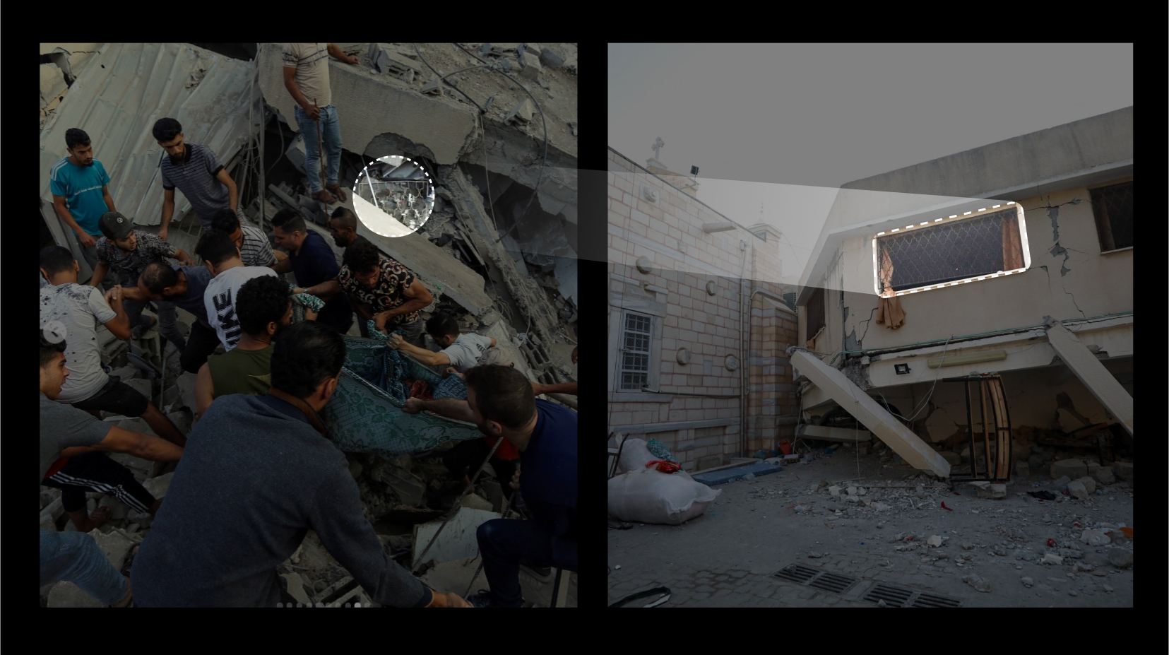
Images posted on Instagram of people rescuing others from under the rubble of the collapsed structure also revealed details of the building, which helped us further examine the site of the attack.
The Israeli military stated that the airstrike attacked a “command and control center belonging to a Hamas terrorist.”
A window with certain patterns can be seen among the rubble. We analyzed the similarities between image 1 and the window frame in image 2. Images 1 and 2 combined below show a visual comparison of the pillared building’s window pattern and the remnants of the structure at the site of the attack. Images 1 and 2 assisted our investigation. The similar patterns mean that the buildings are interconnected and were built in the same time period.
Images of the attacked church compound buildings.
The pillared building, depicted below, appeared in several videos showing the destruction of the compound by the airstrike. By using the image below we were able to confirm that the same building that was impacted by the strike, and is leaning towards the Church's eastern wall, is the one that we located by satellite.
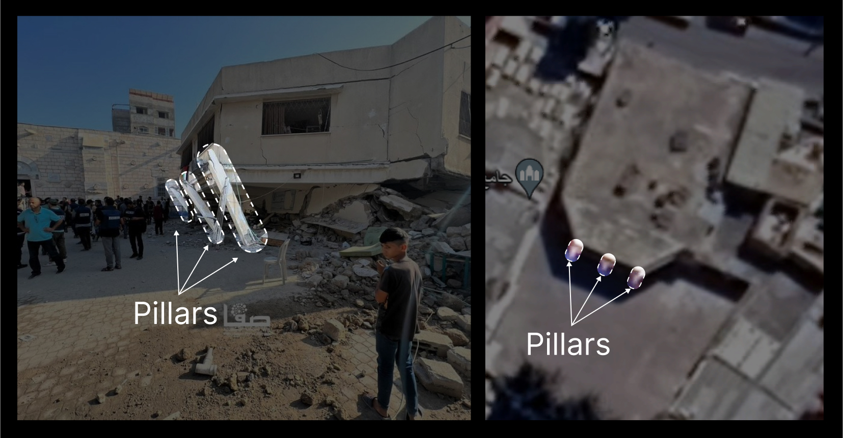
Left: The three pillars of the building impacted by the airstrike. Right: Satellite imagery of the building that was impacted by the airstrike also showing the building's three pillars. White circles/arrows: The three pillars of the building impacted by the airstrike.
Archbishop Alexios, the bishop of the church, confirmed in an interview with Middle East Monitor that the Israeli military attacked the “offices of the church” that were being used as a shelter for people who had fled their homes. Some of the church’s facilities were also used as shelters for civilians in the 2014 Gaza war.
Videos by YouTube vloggers describing the structure of the Church compound were also used in this analysis. A video taken in the churchyard before the 2023 war shows a 360-degree view of the church compound. We compared this video with the report shown in Archbishop Alexios’ interview and located the “assembly building,” which is one of a number of buildings that make up the church compound. This information was obtained from videos archived by the social media pages of the church and others working there.
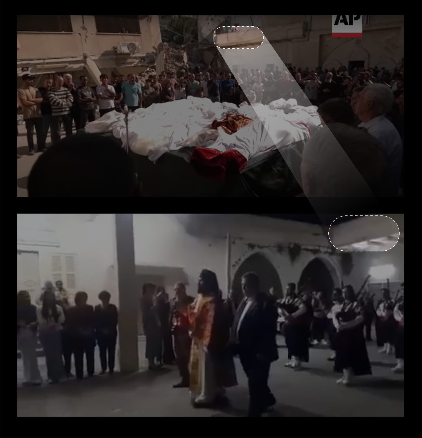
Images from the funeral on October 20, and ceremonies from inside the church compound.
All of the information presented above helped us confirm the exact building that was destroyed. In the footage below, it is evident that the strike took place between the assembly building (pillared), and the office (with the flag). The degree of damage varies between the two buildings—the first is severely damaged and leaning against one of the church walls, and the other is only partially damaged. Furthermore, the street side (red-lined corner below) appears in a Reuters report. The building in-between is partially covered by a tinplate, indicated by the red arrows below. This tinplate was shattered around the attack site, shown below.
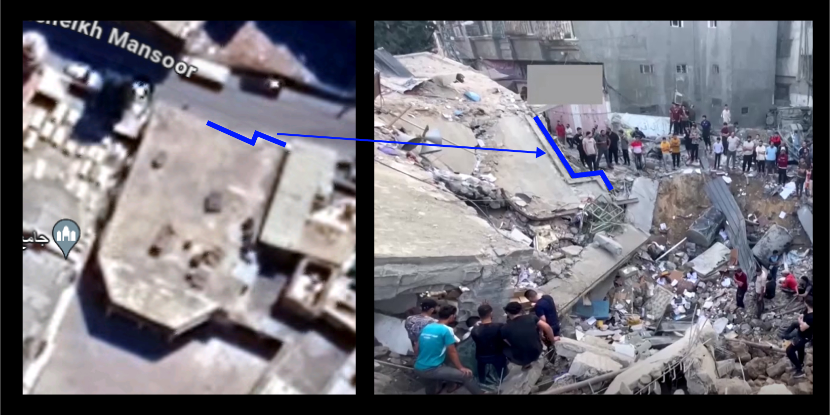
Images: A satellite image (left) and a screenshot from Reuters (right) showing the exact point of contact (location) of the projectile used in the attack.
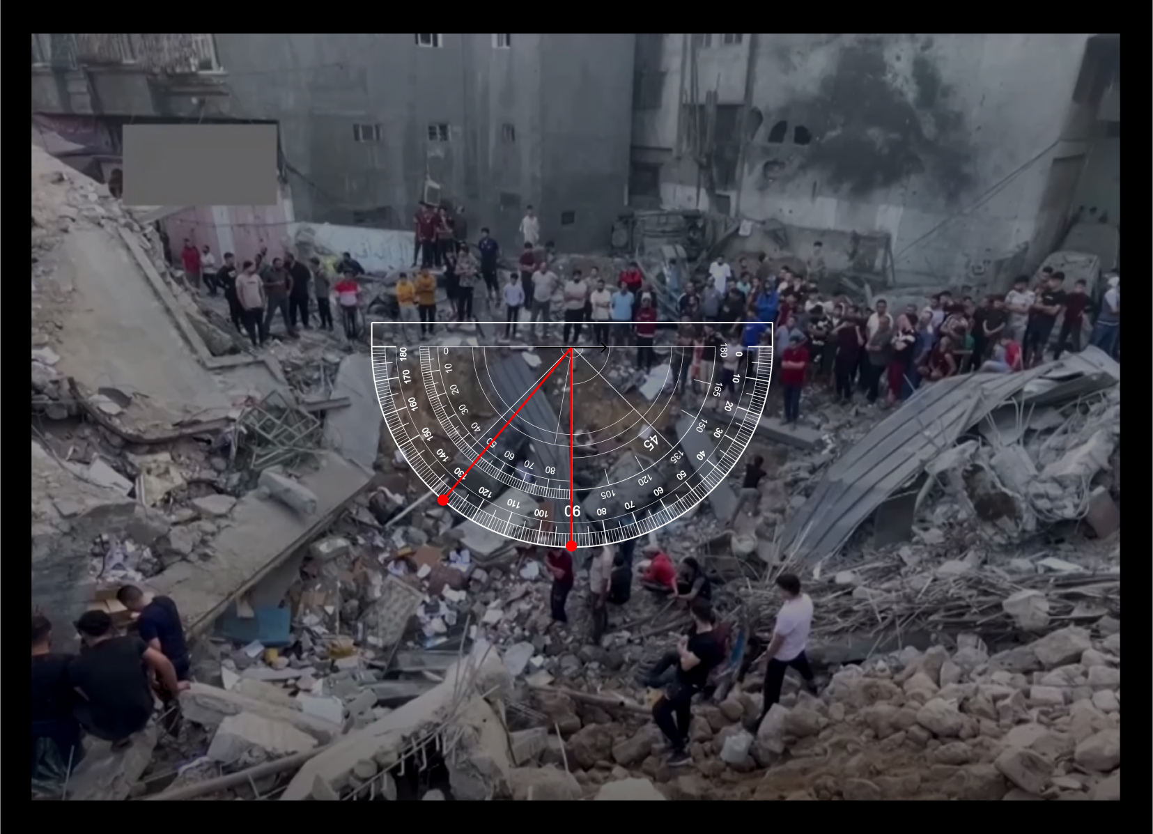
An image showing the depth angle of the strike, using an online protractor tool to provide a numerical presentation for the angle of the attacked site.
A video report provided a street view of Alsheikh Mansoor Street after the airstrike, showing people in the street outside the attacked building. The video shows a tinplate-covered top of a building, showing similarities and matches between both the deleted Israeli military satellite video and the Reuters report. The trees in the yard of the building survived and are still next to the red-marked corner at the top of the building.
Images of the attacked building, marked by a blue X, from The New Arab (top) and an online satellite image (bottom).
Satellite images showing the impact through before and after images of the compound area: The building reportedly targeted is missing in this comparative visual presentation.
Possible Responsibility
The Israeli military confirmed their attack on the church compound, not only verbally, but also through their official social media accounts, such as on X (formerly Twitter). Several screenshots of their satellite footage showing the location of the attack were deleted after they were posted on the Israeli occupation force’s official X account.
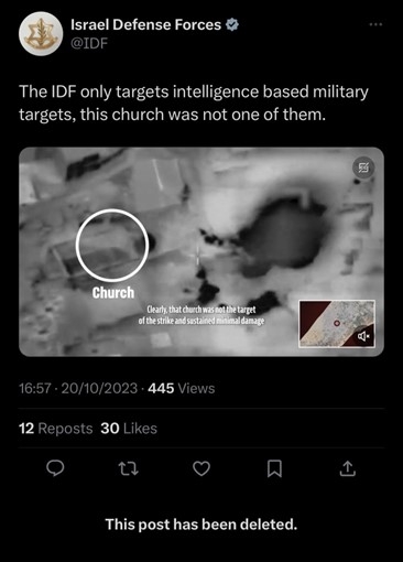
A post by the Israeli military on X (formerly Twitter) claiming to only target military targets, and denying that the Israeli military targeted the Saint Porphyrius church. This investigation determines the exact location of the attack, disproving the Israeli military’s above claim. The post was deleted.
The Israeli military told CNN that “IDF fighter jets struck the command and control center belonging to a Hamas terrorist involved in the launching of rockets and mortars toward Israel.” The Israeli military also said that “Hamas intentionally embeds its assets in civilian areas and uses the residents of the Gaza Strip as human shields.”
Images clarifying the Israeli occupation forces’ targeting of the destroyed building (red dot). First image: The targeted building (red and black circle), Saint Porphyrius church (white circle), and the minaret of a mosque (orange square). Second image: The minaret of a mosque (orange square), the impacted Church buildings (blue), and the building that the Israeli military claimed to be targeting (green).
It appears the Israeli military did not uphold its commitment to the precautions and principles stipulated in the 1954 Hague Convention for the Protection of Cultural Property in the Event of Armed Conflict. This agreement prohibits assault against cultural properties and stresses the significance of protecting cultural heritage during armed conflict.
Article 57 of Additional Protocol I of the 1977 Geneva Conventions stipulates, regarding assaults, that warring parties shall:
Take all feasible precautions in the choice of means and methods of attack with a view to avoiding, and in any event to minimizing, incidental loss of civilian life, injury to civilians and damage to civilian objects.
The Article also requires precautions to limit accidental damages to the greatest extent feasible.
After analyzing social media posts, reports, and testimonies from open-source data, our team found no evidence that the Israeli military issued a warning to people who sought refuge in the Saint Porphyrius church, or to church workers, prior to initiating the attack. Church workers emphasized that they had not received warning from the Israeli military before the attack.
International humanitarian law stipulates that, when preparing for and carrying out attacks, all warring parties are obligated to take precautionary measures to spare the civilian population and civilian objects, and that parties must give “effective advance warning of attacks which may affect the civilian population, unless circumstances do not permit.”
It seems the Israeli military did not commit to taking necessary precautions under international law prior to the assault on the Saint Porphyrius church in the Old City of Gaza.